Dive Site: 120m USAT Liberty Shipwreck

USAT Liberty Shipwreck: Possibly the World’s Easiest Wreck Dive

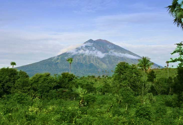
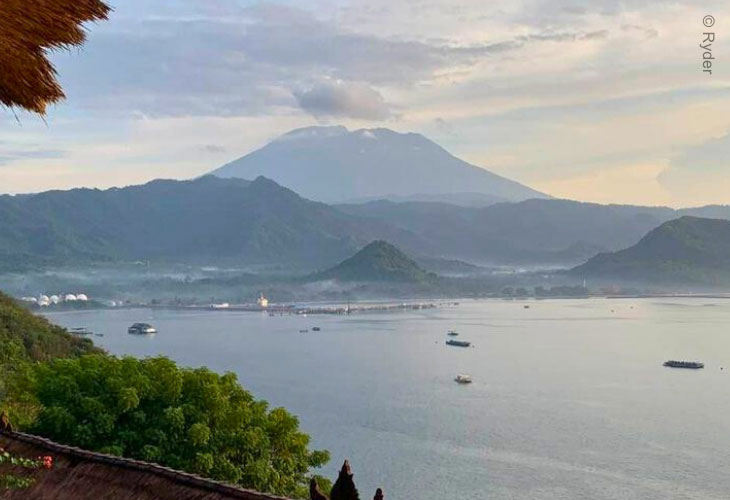
The Liberty was torpedoed by the Japanese off the coast of Lombok. Although attempts were made to tow the ship to north Bali, it was taking on too much water and therefore was semi-beached at Tulamben. During the last eruption of Mt Agung, Bali’s highest and most sacred mountain, the earth tremors roched the boat down the beach and into the sea.

The USAT Liberty Shipwreck lies a mere 30m offshore, and almost parallel to the beach, making it suitable for all levels of certification and experience. The shallowest part of the wreck where it touches the sand slope is at 5-10m while average depth along the middle is 16-20m. The lower edge of the wreck, the furthest down the slope, is 20-28m at high tide.

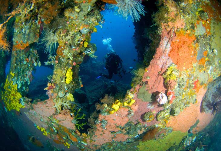
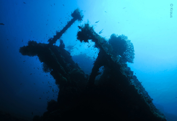
The wreck is pretty broken up, no penetration possible. But you can still see the guns, toilets, boilers, anchor chain, etc. A truly lovely dive site!

USAT-Liberty-Shipwreck

USAT Liberty Shipwreck for Underwater Photographers

The USAT Liberty Shipwreck is very popular with underwater photographers/videographers as it is totally encrusted in anemones, gorgonian fans, hard and soft corals.

In addition the black sand provides an excellent colour contrast for the incredible variety of marine life, which includes a school of 100s of Big-eyed trevallys (length 30cm/12in) and over 400 other species of fish.

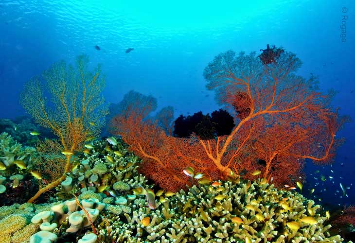
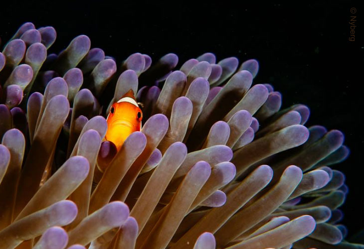
Diving on, in and around the Liberty Shipwreck, you are quite likely to see a high percentage of the marine life shown in any Indo-Pacific Reef Guide book. That is what keeps divers coming back time and time again.

Each area of the Liberty Shipwreck offers something different to see!

USAT-Liberty-with-Anemones

Night and Early Morning Wreck Dives

Night diving on the Wreck is always great but particularly so during the full moon. You may see Spanish dancers and the school of huge Bumphead parrotfish in their sleeping cocoons. Also Flashlight fish, Bobtail squid, even phosphorescence, and the basket stars! – where else in the world could you make such an easy and varied Night Dive?

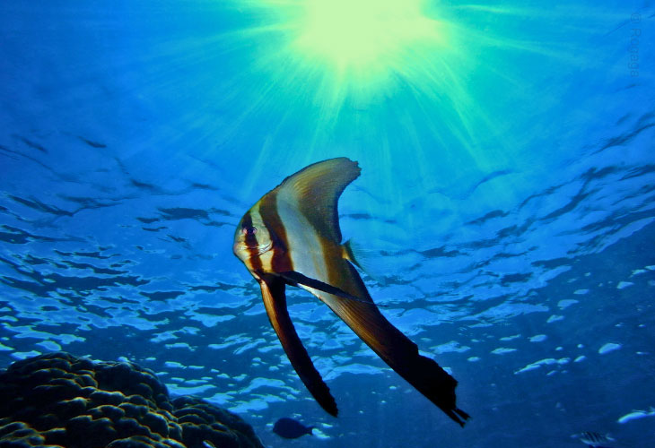
If you dive early enough, 06-07:00, you may see the school of Bumphead parrotfish heading out for breakfast. This is also the most likely time of day to see Mola-Mola, Manta rays, turtles and any Whalesharks passing through. In our opinion, it’s the best time of day to dive the wreck.

USAT-Liberty-Wreck-Dives

Dive Sites: Menjangan Island

Menjangan Island Dive Sites

Menjangan Island became Bali’s first internationally-known diving location, famous for its wall-diving with great visibility (50m at certain times of the year).

Part of West Bali National Park, Menjangan Island is 30 minutes by local boat from mainland Bali and offers warm waters with stunning visibility that can reach 50m+. The island’s white sand beaches provide good, and well-protected, snorkelling opportunities.

The walls at Menjangan go from 10 to 26-60m+ and are full of nooks and crannies, overhangs and crevasses with soft corals, sponges and Bali’s highest concentration of Gorgonian seafans (some with pygmy seahorses). The fishlife is prolific and turtles are regular visitors.

Although Whalesharks may be sighted, pelagics are fairly rare here as the island is protected from the cold ocean currents felt at some other Bali dive sites.

The main three dive sites are Garden Eel Point, Pos Two, and the small wooden Anker Wreck (35-50m) where the calm conditions and good visibility can make it easy to forget that this is a deep dive.

Menjangan-Island-Gorgonian-Seafans

Best Time to Dive

Although the best diving in Menjangan Island is said to be from April to November (during the south east monsoon), the island can be dived year round as it offers some of the most protected diving in Bali.

The clarity of the water can at times be amazing, July to September often yields the best visibility and a current of more than 1 knot is unusual. However, as Menjangan is protected from the cold currents coming in from the open sea, there are only rare sightings of larger fish.

Menjangan-Island-Batfish

Mount Agung

Mount Agung is Bali’s Most Sacred Mountain

Mount Agung (Gunung Agung) lies in central-eastern Bali and, at 3,148m, is Bali’s highest point by almost 1km – it is even visible in the early mornings from my house in south west Bali. The height of Mt Agung actually affects Bali’s climate: clouds coming from the west drop their rain (unsurprisingly) on the west side of the mountain which is why east Bali is usually dry and barren.

According to Balinese Hindus, the gods created mountains as their thrones meaning Mt Agung, as the highest, is Bali’s most sacred mountain and is therefore the location of Pura Besakih, Bali’s ‘mother’ temple.

Mount-Agung-Scenery

Sunrise Rise Trekking on Mount Agung

Sunrise Trekking on Mount Agung is very popular: you leave, with your guide, from a fixed departure point in the early hours so you can be at the top to watch the sunrise.

Mt Agung is an active stratovolcano (built of layered lava), with the most recent major eruption in 1963. Those lava flows missed Besakih Temple by only a few metres in places; that was regarded by the Balinese people as miraculous and a signal from the gods that they wished to demonstrate their power but not destroy the monument the Balinese faithful had erected.

The earth tremors of the 1963 Mt Agung eruption were what caused the 120m USAT Liberty Shipwreck to slide off the beach and into the shallows of Tulamben Bay. For that at least, we can be thankful.

Mount-Agung-from-Blue-Lagoon

The Burning Ring of Fire

Bali is part of ‘The Ring of Fire’ and we therefore have several other dormant volcanoes, eg: Mount Batur – although we do see occasional puffs of smoke.

Book Mt Agung Sunrise Trekking

Click below for more Bali Information: